This one is on route 9 southern Vermont about a mile west of Wilmington.


This rock clearly got SQUISHED, metamorphosized by, I think , the Taconic Orogeny. What sort of rock was it before squishing? Lets look
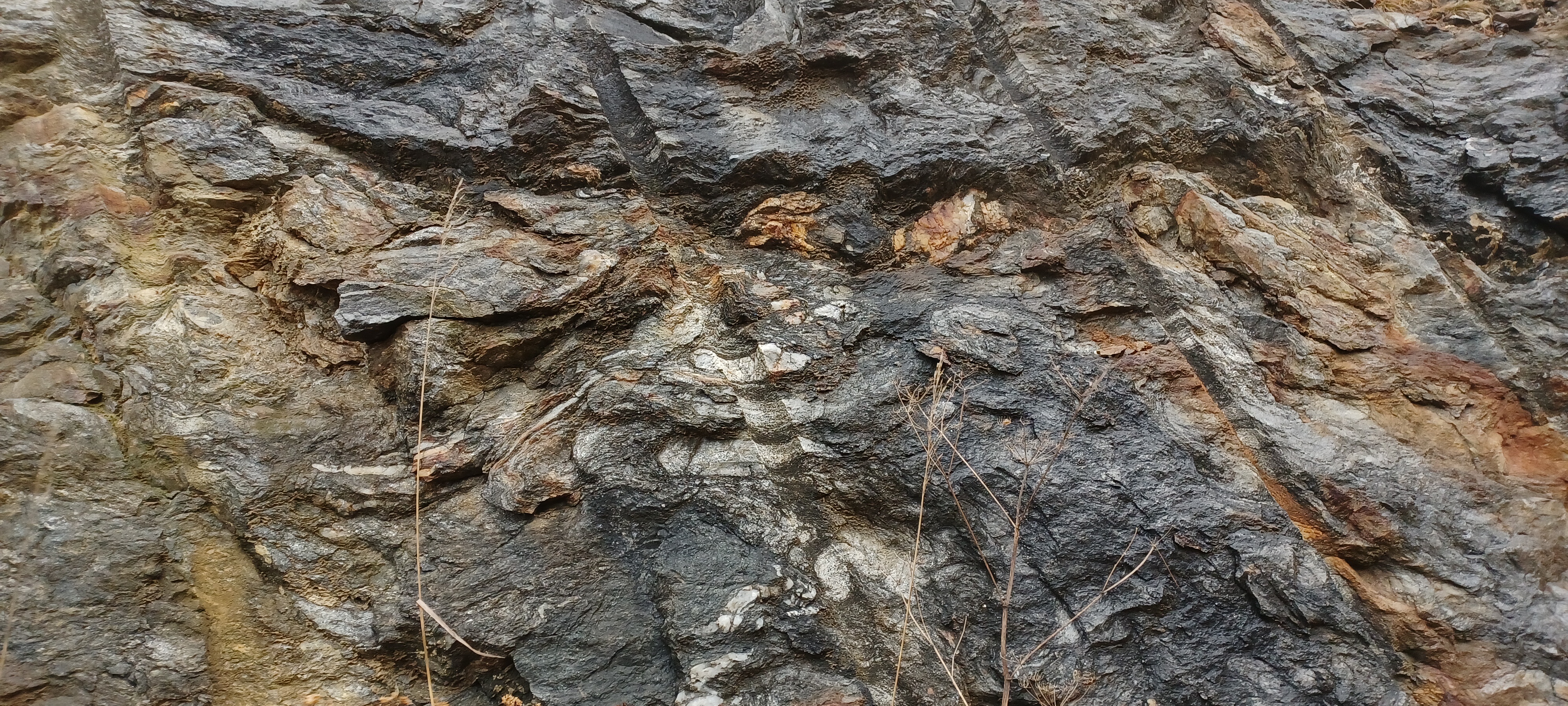
if you expand the picture you see micacous rock so there was mud, and you also see quartz pebbles pulled and bent like taffy. But that was all long ago, about 500million years ago.
what really caught my eye was some tiny crystals that grew more recently in the fractures inside this monster. Here you can see some calcite (probably) crusts growing where the rock splits.

It gets more exciting: here you can see some tiny crystals scattered on the surface. (the bare spot to the left is where i chiseled off a sample with my new rock chisel, so that was exciting).

lets look at those crystals.


Look at those little salmon flakes and milky cuby shaped things. mms wide. Calcite? A friend suggested maybe gypsum. I Shall find out. I wish I could tell how long these took to grow and when!
Geology description of this region:
Y1, 2bg
rt 9 and primrose lane outcrop vermont
VT Geological Map calls it...
Biotite-quartz-plagioclase gneiss (Middle and Early Mesoproterozoic)—A widespread, heterogeneous unit of well-layered, predominantly biotite-quartz plagioclase gneisses containing variable amounts of magnetite, hornblende, and garnet, and little potash feldspar. Plagioclase-rich layers contain epidote-crowded plagioclase and isolated igneous quartz grains and probably are metadacitic volcanics and volcaniclastic rocks. Unit varies from very dark gray biotitic gneiss to light-gray more plagioclase- and quartz-rich gneiss, contains quartz-rich layers, minor amphibolites, rusty-weathering garnetiferous quartzites, and calc-silicates and marbles which locally are mappable. Association suggests an accumulation of volcaniclastic and clastic sediments. Areas of Y1,2bg associated with 1,400- to 1,350-Ma intrusive rocks range down into the Early Mesoproterozoic, whereas the upper parts may be Middle Mesoproterozoic. Rocks mapped as Y1,2bg may not all be correlative
from this website
https://geodata.vermont.gov/datasets/VTANR::bedrock-geologic-map-of-vermont-units/explore?location=42.866656%2C-72.900486%2C14.19
i don't know how to use it yet.


No comments:
Post a Comment